
- Start >
- Groundwater >
- Waterlevel of deep layer >
- Isar >
- München-Riem T 7 >
- Current data

Current data München-Riem T 7
Groundwater levels of the last 12 months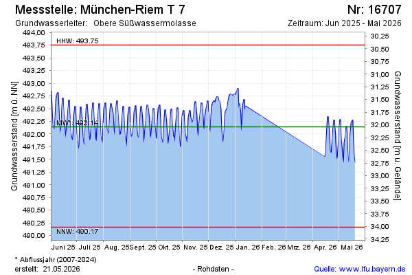
note
Datenaktualisierung erfolgt quartalsweise
Groundwater level [m above sealevel]: 492.40
Distance to surface [m]: 31.88
Last value from 05.02.2025 12:00
Ground level [m above sealevel]: 524.28
| Date | Groundwater level [m above sealevel] |
|---|---|
| 05.02.2025 | 492.37 |
| 04.02.2025 | 492.52 |
| 03.02.2025 | 492.83 |
| 02.02.2025 | 493.05 |
| 01.02.2025 | 492.92 |
| 31.01.2025 | 492.66 |
| 30.01.2025 | 492.33 |
| 29.01.2025 | 492.34 |
© Bayerisches Landesamt für Umwelt 2025