
- Start >
- Groundwater >
- Waterlevel of deep layer >
- Isar >
- REICHERTSHEIM T1 >
- Current data

Current data REICHERTSHEIM T1
Groundwater levels of the last 12 months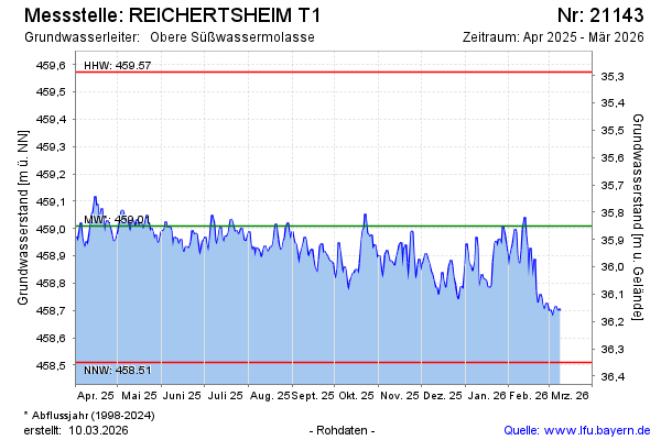
Groundwater level [m above sealevel]: 458.98
Distance to surface [m]: 35.88
Last value from 16.02.2025 10:00
Ground level [m above sealevel]: 494.86
| Date | Groundwater level [m above sealevel] |
|---|---|
| 16.02.2025 | 458.99 |
| 15.02.2025 | 458.95 |
| 14.02.2025 | 458.96 |
| 13.02.2025 | 459.00 |
| 12.02.2025 | 458.98 |
| 11.02.2025 | 458.95 |
| 10.02.2025 | 458.93 |
| 09.02.2025 | 458.92 |
© Bayerisches Landesamt für Umwelt 2025