
- Start >
- Groundwater >
- Waterlevel of deep layer >
- Isar >
- ROTTBACH T 11 >
- Current data

Current data ROTTBACH T 11
Groundwater levels of the last 12 months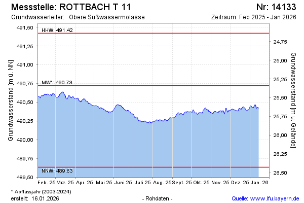
Groundwater level [m above sealevel]: 490.64
Distance to surface [m]: 25.42
Last value from 13.03.2025 09:00
Ground level [m above sealevel]: 516.06
| Date | Groundwater level [m above sealevel] |
|---|---|
| 13.03.2025 | 490.64 |
| 12.03.2025 | 490.63 |
| 11.03.2025 | 490.62 |
| 10.03.2025 | 490.62 |
| 09.03.2025 | 490.61 |
| 08.03.2025 | 490.59 |
| 07.03.2025 | 490.58 |
| 06.03.2025 | 490.57 |
© Bayerisches Landesamt für Umwelt 2025