
- Start >
- Groundwater >
- Waterlevel of deep layer >
- Isar >
- TAUFKIRCHEN B. MUE. >
- Current data

Current data TAUFKIRCHEN B. MUE.
Groundwater levels of the last 12 months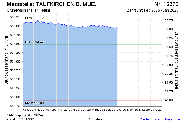
note
Datenaktualisierung erfolgt quartalsweise
Groundwater level [m above sealevel]: 535.12
Distance to surface [m]: 37.79
Last value from 21.09.2024 13:00
Ground level [m above sealevel]: 572.91
| Date | Groundwater level [m above sealevel] |
|---|---|
| 21.09.2024 | 535.11 |
| 20.09.2024 | 535.12 |
| 19.09.2024 | 535.12 |
| 18.09.2024 | 535.12 |
| 17.09.2024 | 535.12 |
| 16.09.2024 | 535.10 |
| 15.09.2024 | 535.07 |
| 14.09.2024 | 535.06 |
© Bayerisches Landesamt für Umwelt 2024