
- Start >
- Groundwater >
- Waterlevel of deep layer >
- Obere Donau >
- Buchschwabach B4 >
- Current data

Current data Buchschwabach B4
Groundwater levels of the last 12 months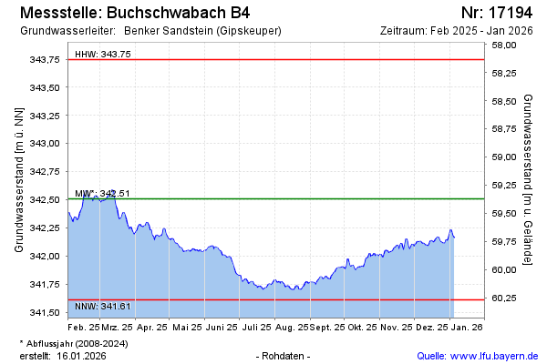
Groundwater level [m above sealevel]: 342.58
Distance to surface [m]: 59.30
Last value from 17.02.2025 10:00
Ground level [m above sealevel]: 401.88
| Date | Groundwater level [m above sealevel] |
|---|---|
| 17.02.2025 | 342.58 |
| 16.02.2025 | 342.55 |
| 15.02.2025 | 342.49 |
| 14.02.2025 | 342.43 |
| 13.02.2025 | 342.41 |
| 12.02.2025 | 342.38 |
| 11.02.2025 | 342.34 |
| 10.02.2025 | 342.32 |
© Bayerisches Landesamt für Umwelt 2025