
- Start >
- Groundwater >
- Waterlevel of deep layer >
- Obere Donau >
- DIETENHOFEN >
- Current data

Current data DIETENHOFEN
Groundwater levels of the last 12 months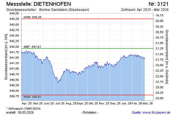
Groundwater level [m above sealevel]: 341.67
Distance to surface [m]: 21.50
Last value from 27.12.2024 13:00
Ground level [m above sealevel]: 363.17
| Date | Groundwater level [m above sealevel] |
|---|---|
| 27.12.2024 | 341.69 |
| 26.12.2024 | 341.65 |
| 25.12.2024 | 341.62 |
| 24.12.2024 | 341.61 |
| 23.12.2024 | 341.63 |
| 22.12.2024 | 341.61 |
| 21.12.2024 | 341.48 |
| 20.12.2024 | 341.47 |
© Bayerisches Landesamt für Umwelt 2024