
- Start >
- Groundwater >
- Waterlevel of deep layer >
- Obere Donau >
- Haslangkreit T6 >
- Chart of total period

Chart of total period Haslangkreit T6
Groundwater levels of the total period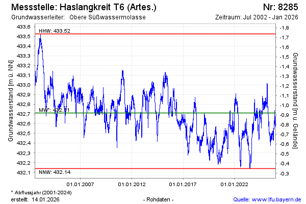
Groundwater level [m above sealevel]: 433.01
Distance to surface [m]: -1.22
Last value from 13.03.2025 10:00
Ground level [m above sealevel]: 431.79
| Date | Groundwater level [m above sealevel] |
|---|---|
| 13.03.2025 | 433.02 |
| 12.03.2025 | 433.02 |
| 11.03.2025 | 433.01 |
| 10.03.2025 | 433.00 |
| 09.03.2025 | 432.99 |
| 08.03.2025 | 432.96 |
| 07.03.2025 | 432.94 |
| 06.03.2025 | 432.92 |
© Bayerisches Landesamt für Umwelt 2025