
- Start >
- Groundwater >
- Waterlevel of deep layer >
- Obere Donau >
- IHRLERSTEIN TIEF K1 >
- Year chart of precipitation

Year chart of precipitation IHRLERSTEIN TIEF K1
Groundwater levels of the last 12 months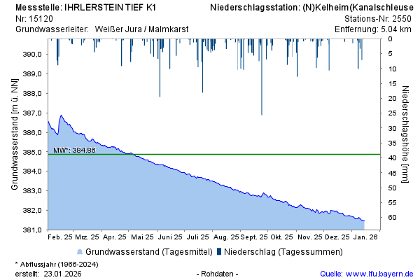
Groundwater level [m above sealevel]: 384,36
Distance to surface [m]: 95,67
Last value from 25.12.2024 10:00
Ground level [m above sealevel]: 480.03
© Bayerisches Landesamt für Umwelt 2024