
- Start >
- Groundwater >
- Waterlevel of deep layer >
- Obere Donau >
- Illertissen T 12 >
- Current data

Current data Illertissen T 12
Groundwater levels of the last 12 months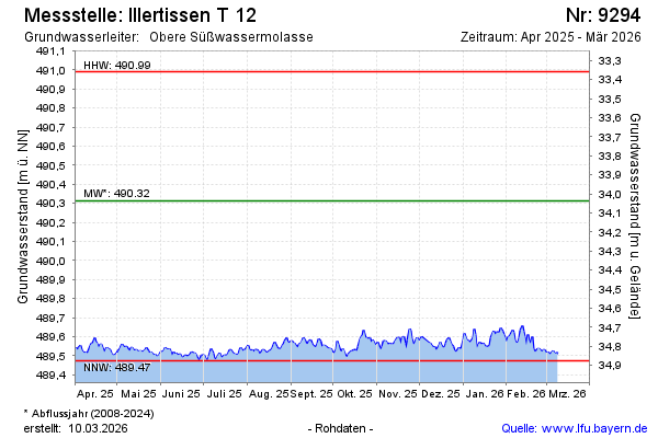
Groundwater level [m above sealevel]: 489.61
Distance to surface [m]: 34.74
Last value from 16.02.2025 10:00
Ground level [m above sealevel]: 524.35
| Date | Groundwater level [m above sealevel] |
|---|---|
| 16.02.2025 | 489.61 |
| 15.02.2025 | 489.59 |
| 14.02.2025 | 489.59 |
| 13.02.2025 | 489.62 |
| 12.02.2025 | 489.61 |
| 11.02.2025 | 489.59 |
| 10.02.2025 | 489.58 |
| 09.02.2025 | 489.58 |
© Bayerisches Landesamt für Umwelt 2025