
- Start >
- Groundwater >
- Waterlevel of deep layer >
- Obere Donau >
- KALBENSTEINBERG BO 3 >
- Chart of total period

Chart of total period KALBENSTEINBERG BO 3
Groundwater levels of the total period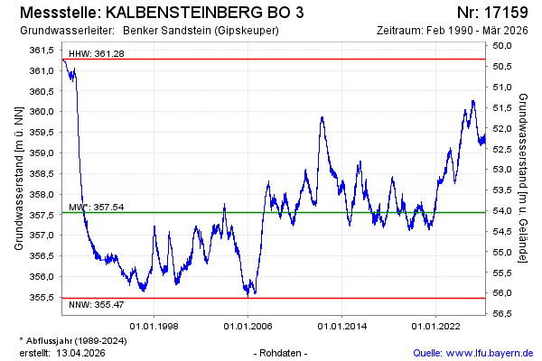
Groundwater level [m above sealevel]: 360.28
Distance to surface [m]: 51.32
Last value from 10.03.2025 11:58
Ground level [m above sealevel]: 411.60
| Date | Groundwater level [m above sealevel] |
|---|---|
| 10.03.2025 | 360.28 |
| 09.03.2025 | 360.28 |
| 08.03.2025 | 360.27 |
| 07.03.2025 | 360.26 |
| 06.03.2025 | 360.24 |
| 05.03.2025 | 360.23 |
| 04.03.2025 | 360.22 |
| 03.03.2025 | 360.21 |
© Bayerisches Landesamt für Umwelt 2025