
- Start >
- Groundwater >
- Waterlevel of deep layer >
- Obere Donau >
- LOHSTADT 825 >
- Chart of total period

Chart of total period LOHSTADT 825
Groundwater levels of the total period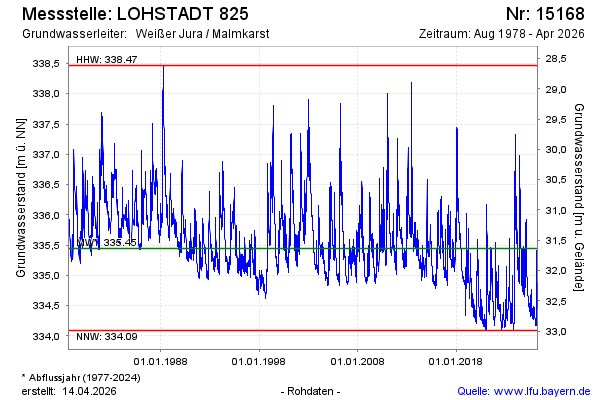
Groundwater level [m above sealevel]: 335.56
Distance to surface [m]: 31.52
Last value from 12.01.2025 10:00
Ground level [m above sealevel]: 367.08
| Date | Groundwater level [m above sealevel] |
|---|---|
| 12.01.2025 | 335.58 |
| 11.01.2025 | 335.67 |
| 10.01.2025 | 335.87 |
| 09.01.2025 | 335.50 |
| 08.01.2025 | 335.20 |
| 07.01.2025 | 335.02 |
| 06.01.2025 | 334.92 |
| 05.01.2025 | 334.84 |
© Bayerisches Landesamt für Umwelt 2025