
- Start >
- Groundwater >
- Waterlevel of deep layer >
- Obere Donau >
- MONHEIM 568 >
- Chart of total period

Chart of total period MONHEIM 568
Groundwater levels of the total period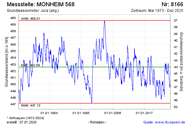
Groundwater level [m above sealevel]: 451.72
Distance to surface [m]: 44.88
Last value from 19.11.2024 12:02
Ground level [m above sealevel]: 496.60
| Date | Groundwater level [m above sealevel] |
|---|---|
| 19.11.2024 | 451.67 |
| 18.11.2024 | 451.66 |
| 17.11.2024 | 451.67 |
| 16.11.2024 | 451.64 |
| 15.11.2024 | 451.62 |
| 14.11.2024 | 451.63 |
| 13.11.2024 | 451.62 |
| 12.11.2024 | 451.65 |
© Bayerisches Landesamt für Umwelt 2024