
- Start >
- Groundwater >
- Waterlevel of deep layer >
- Obere Donau >
- Moorenweis T 15 >
- Chart of total period

Chart of total period Moorenweis T 15
Groundwater levels of the total period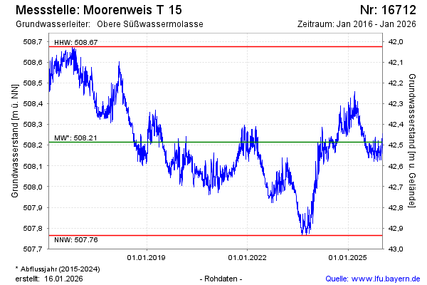
Groundwater level [m above sealevel]: 508.47
Distance to surface [m]: 42.23
Last value from 13.03.2025 08:00
Ground level [m above sealevel]: 550.70
| Date | Groundwater level [m above sealevel] |
|---|---|
| 13.03.2025 | 508.46 |
| 12.03.2025 | 508.45 |
| 11.03.2025 | 508.43 |
| 10.03.2025 | 508.43 |
| 09.03.2025 | 508.42 |
| 08.03.2025 | 508.39 |
| 07.03.2025 | 508.37 |
| 06.03.2025 | 508.35 |
© Bayerisches Landesamt für Umwelt 2025