
- Start >
- Groundwater >
- Waterlevel of deep layer >
- Obere Donau >
- Moorenweis T 15 >
- Current data

Current data Moorenweis T 15
Groundwater levels of the last 12 months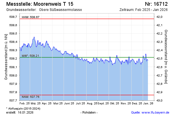
Groundwater level [m above sealevel]: 508.25
Distance to surface [m]: 42.45
Last value from 25.12.2024 09:00
Ground level [m above sealevel]: 550.70
| Date | Groundwater level [m above sealevel] |
|---|---|
| 25.12.2024 | 508.25 |
| 24.12.2024 | 508.28 |
| 23.12.2024 | 508.34 |
| 22.12.2024 | 508.36 |
| 21.12.2024 | 508.30 |
| 20.12.2024 | 508.30 |
| 19.12.2024 | 508.34 |
| 18.12.2024 | 508.29 |
© Bayerisches Landesamt für Umwelt 2024