
- Start >
- Groundwater >
- Waterlevel of deep layer >
- Obere Donau >
- Reichelsdorf B 5 >
- Current data

Current data Reichelsdorf B 5
Groundwater levels of the last 12 months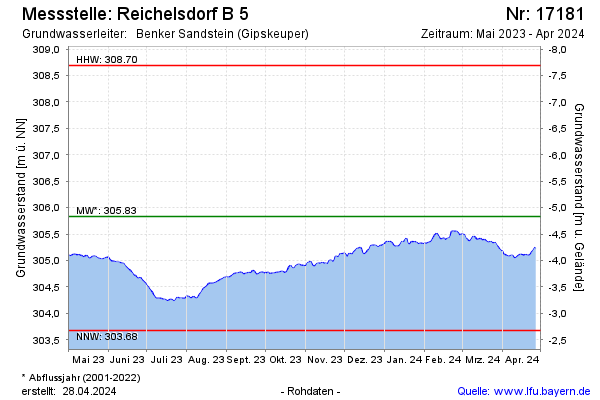
Groundwater level [m above sealevel]: 305.59
Distance to surface [m]: -4.59
Last value from 13.01.2025 09:00
Ground level [m above sealevel]: 301.00
| Date | Groundwater level [m above sealevel] |
|---|---|
| 13.01.2025 | 305.58 |
| 12.01.2025 | 305.61 |
| 11.01.2025 | 305.64 |
| 10.01.2025 | 305.66 |
| 09.01.2025 | 305.71 |
| 08.01.2025 | 305.68 |
| 07.01.2025 | 305.68 |
| 06.01.2025 | 305.70 |
© Bayerisches Landesamt für Umwelt 2025