
- Start >
- Groundwater >
- Waterlevel of deep layer >
- Obere Donau >
- TAUBENB.FORST B 937 >
- Current data

Current data TAUBENB.FORST B 937
Groundwater levels of the last 12 months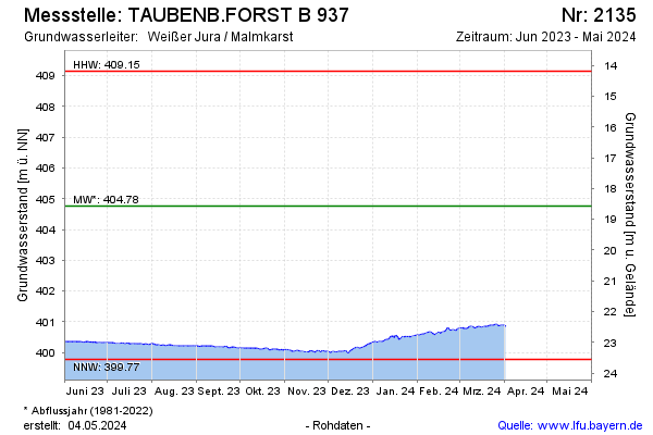
Groundwater level [m above sealevel]: 401.53
Distance to surface [m]: 21.80
Last value from 13.01.2025 10:19
Ground level [m above sealevel]: 423.33
| Date | Groundwater level [m above sealevel] |
|---|---|
| 13.01.2025 | 401.53 |
| 12.01.2025 | 401.53 |
| 11.01.2025 | 401.56 |
| 10.01.2025 | 401.54 |
| 09.01.2025 | 401.62 |
| 08.01.2025 | 401.59 |
| 07.01.2025 | 401.58 |
| 06.01.2025 | 401.62 |
© Bayerisches Landesamt für Umwelt 2025