
- Start >
- Groundwater >
- Waterlevel of deep layer >
- Obere Donau >
- TAUBENB.FORST B 937 >
- Chart of total period

Chart of total period TAUBENB.FORST B 937
Groundwater levels of the total period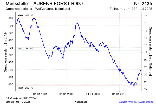
Groundwater level [m above sealevel]: 401.30
Distance to surface [m]: 22.03
Last value from 29.07.2024 09:18
Ground level [m above sealevel]: 423.33
| Date | Groundwater level [m above sealevel] |
|---|---|
| 29.07.2024 | 401.30 |
| 28.07.2024 | 401.29 |
| 27.07.2024 | 401.32 |
| 26.07.2024 | 401.32 |
| 25.07.2024 | 401.32 |
| 24.07.2024 | 401.30 |
| 23.07.2024 | 401.29 |
| 22.07.2024 | 401.28 |
© Bayerisches Landesamt für Umwelt 2024