
- Start >
- Groundwater >
- Waterlevel of deep layer >
- Obere Donau >
- THANNHAUSEN A,FB 889 >
- Current data

Current data THANNHAUSEN A,FB 889
Groundwater levels of the last 12 months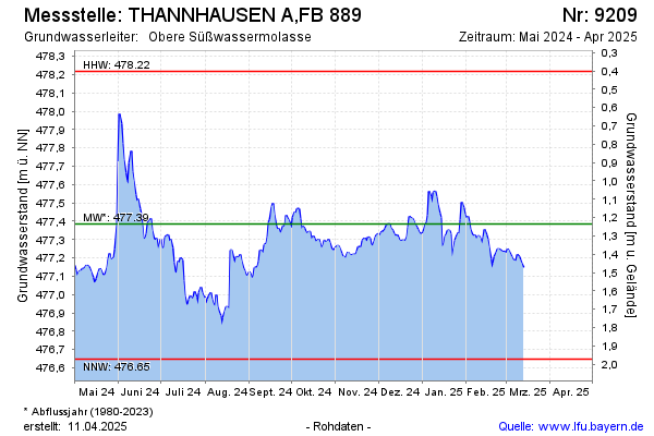
Groundwater level [m above sealevel]: 477.14
Distance to surface [m]: 1.48
Last value from 13.03.2025 08:41
Ground level [m above sealevel]: 478.62
Date | Groundwater level [m above sealevel] |
|---|---|
| 31.12.2024 | 477.33 |
| 30.12.2024 | 477.34 |
| 29.12.2024 | 477.35 |
| 28.12.2024 | 477.37 |
| 27.12.2024 | 477.39 |
| 26.12.2024 | 477.40 |
| 25.12.2024 | 477.42 |
| 24.12.2024 | 477.42 |
© Bayerisches Landesamt für Umwelt 2025