
- Start >
- Groundwater >
- Waterlevel of deep layer >
- Obere Donau >
- UNTERPFRAUNDORF W1 >
- Chart of total period

Chart of total period UNTERPFRAUNDORF W1
Groundwater levels of the total period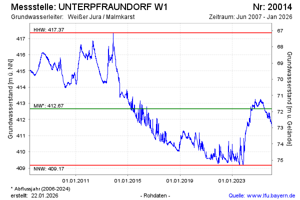
Groundwater level [m above sealevel]: 412.85
Distance to surface [m]: 71.64
Last value from 26.11.2024 10:00
Ground level [m above sealevel]: 484.49
| Date | Groundwater level [m above sealevel] |
|---|---|
| 26.11.2024 | 412.88 |
| 25.11.2024 | 412.91 |
| 24.11.2024 | 412.88 |
| 23.11.2024 | 412.87 |
| 22.11.2024 | 412.96 |
| 21.11.2024 | 413.02 |
| 20.11.2024 | 413.01 |
| 19.11.2024 | 413.03 |
© Bayerisches Landesamt für Umwelt 2024