
- Start >
- Groundwater >
- Waterlevel of deep layer >
- Obere Donau >
- Zusmarshausen T7 >
- Current data

Current data Zusmarshausen T7
Groundwater levels of the last 12 months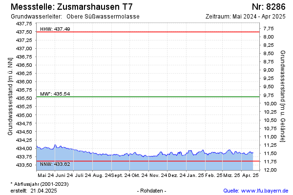
Groundwater level [m above sealevel]: 433.78
Distance to surface [m]: 11.57
Last value from 31.08.2024 08:00
Ground level [m above sealevel]: 445.35
| Date | Groundwater level [m above sealevel] |
|---|---|
| 31.08.2024 | 433.79 |
| 30.08.2024 | 433.79 |
| 29.08.2024 | 433.79 |
| 28.08.2024 | 433.79 |
| 27.08.2024 | 433.78 |
| 26.08.2024 | 433.78 |
| 25.08.2024 | 433.79 |
| 24.08.2024 | 433.82 |
© Bayerisches Landesamt für Umwelt 2024