
- Start >
- Groundwater >
- Waterlevel of deep layer >
- Unterer Main >
- RUECK 178 >
- Chart of total period

Chart of total period RUECK 178
Groundwater levels of the total period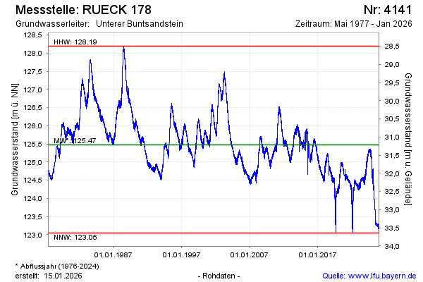
Groundwater level [m above sealevel]: 124.54
Distance to surface [m]: 32.15
Last value from 25.02.2025 10:00
Ground level [m above sealevel]: 156.69
| Date | Groundwater level [m above sealevel] |
|---|---|
| 25.02.2025 | 124.51 |
| 24.02.2025 | 124.52 |
| 23.02.2025 | 124.46 |
| 22.02.2025 | 124.58 |
| 21.02.2025 | 124.65 |
| 20.02.2025 | 124.60 |
| 19.02.2025 | 124.54 |
| 18.02.2025 | 124.60 |
© Bayerisches Landesamt für Umwelt 2025