
- Start >
- Groundwater >
- Waterlevel of deep layer >
- Unterer Main >
- Rügheim MU8 >
- Chart of total period

Chart of total period Rügheim MU8
Groundwater levels of the total period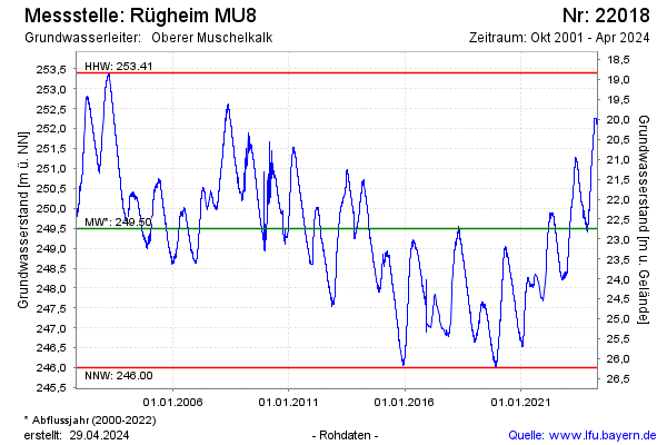
Groundwater level [m above sealevel]: 248.69
Distance to surface [m]: 21.79
Last value from 13.01.2026 10:00
Ground level [m above sealevel]: 270.48
| Date | Groundwater level [m above sealevel] |
|---|---|
| 13.01.2026 | 248.71 |
| 12.01.2026 | 248.69 |
| 11.01.2026 | 248.66 |
| 10.01.2026 | 248.73 |
| 09.01.2026 | 248.76 |
| 08.01.2026 | 248.71 |
| 07.01.2026 | 248.69 |
| 06.01.2026 | 248.68 |
© Bayerisches Landesamt für Umwelt 2026