
- Start >
- Groundwater >
- Waterlevel of deep layer >
- Unterer Main >
- Schleerieth MU2 >
- Current data

Current data Schleerieth MU2
Groundwater levels of the last 12 months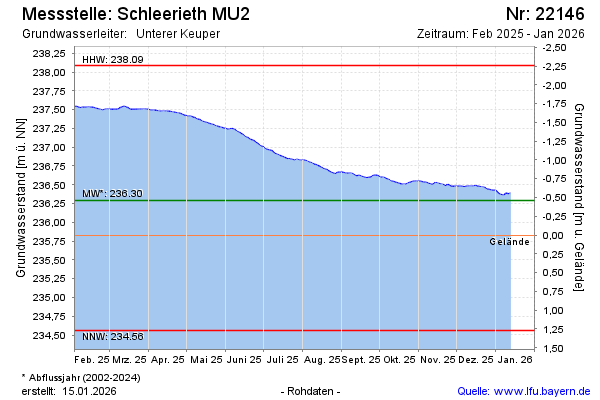
note
Arteser
Groundwater level [m above sealevel]: 237.53
Distance to surface [m]: -1.26
Last value from 14.03.2025 10:00
Ground level [m above sealevel]: 236.27
| Date | Groundwater level [m above sealevel] |
|---|---|
| 14.03.2025 | 237.54 |
| 13.03.2025 | 237.54 |
| 12.03.2025 | 237.53 |
| 11.03.2025 | 237.53 |
| 10.03.2025 | 237.52 |
| 09.03.2025 | 237.51 |
| 08.03.2025 | 237.50 |
| 07.03.2025 | 237.50 |
© Bayerisches Landesamt für Umwelt 2025