
- Start >
- Groundwater >
- Waterlevel of deep layer >
- Unterer Main >
- Unterwittbach S 1 >
- Current data

Current data Unterwittbach S 1
Groundwater levels of the last 12 months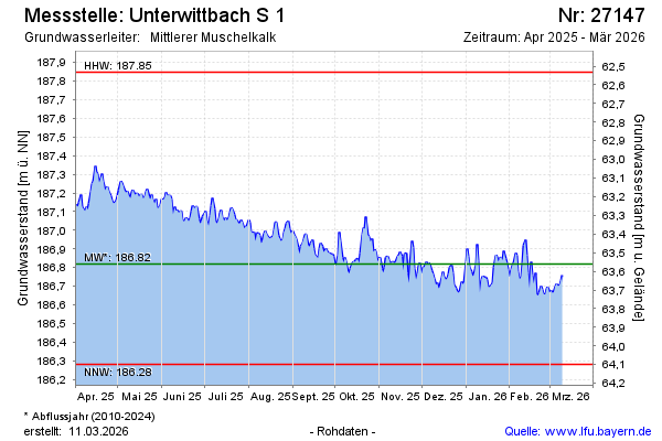
Groundwater level [m above sealevel]: 187.10
Distance to surface [m]: 63.28
Last value from 16.02.2025 09:00
Ground level [m above sealevel]: 250.38
| Date | Groundwater level [m above sealevel] |
|---|---|
| 16.02.2025 | 187.09 |
| 15.02.2025 | 187.06 |
| 14.02.2025 | 187.06 |
| 13.02.2025 | 187.11 |
| 12.02.2025 | 187.10 |
| 11.02.2025 | 187.07 |
| 10.02.2025 | 187.03 |
| 09.02.2025 | 187.02 |
© Bayerisches Landesamt für Umwelt 2025