
- Start >
- Groundwater >
- Waterlevel of deep layer >
- Naab - Regen >
- Gressenwöhr >
- Current data

Current data Gressenwöhr
Groundwater levels of the last 12 months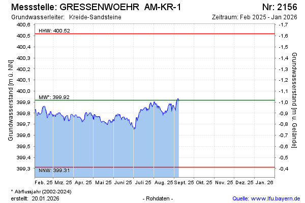
Groundwater level [m above sealevel]: 399.89
Distance to surface [m]: -0.99
Last value from 14.01.2025 12:52
Ground level [m above sealevel]: 398.90
| Date | Groundwater level [m above sealevel] |
|---|---|
| 14.01.2025 | 399.79 |
| 13.01.2025 | 399.78 |
| 12.01.2025 | 399.80 |
| 11.01.2025 | 399.86 |
| 10.01.2025 | 399.86 |
| 09.01.2025 | 399.88 |
| 08.01.2025 | 399.85 |
| 07.01.2025 | 399.84 |
© Bayerisches Landesamt für Umwelt 2025