
- Start >
- Groundwater >
- Waterlevel of deep layer >
- Untere Donau >
- Vilsheim T13 >
- Chart of total period

Chart of total period Vilsheim T13
Groundwater levels of the total period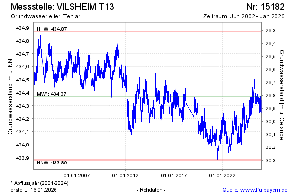
Groundwater level [m above sealevel]: 434.26
Distance to surface [m]: 29.92
Last value from 25.12.2024 10:00
Ground level [m above sealevel]: 464.18
| Date | Groundwater level [m above sealevel] |
|---|---|
| 25.12.2024 | 434.27 |
| 24.12.2024 | 434.29 |
| 23.12.2024 | 434.35 |
| 22.12.2024 | 434.37 |
| 21.12.2024 | 434.31 |
| 20.12.2024 | 434.32 |
| 19.12.2024 | 434.34 |
| 18.12.2024 | 434.30 |
© Bayerisches Landesamt für Umwelt 2024