
- Start >
- Groundwater >
- Waterlevel of deep layer >
- Regnitz >
- Hohenstadt163A >
- Current data

Current data Hohenstadt163A
Groundwater levels of the last 12 months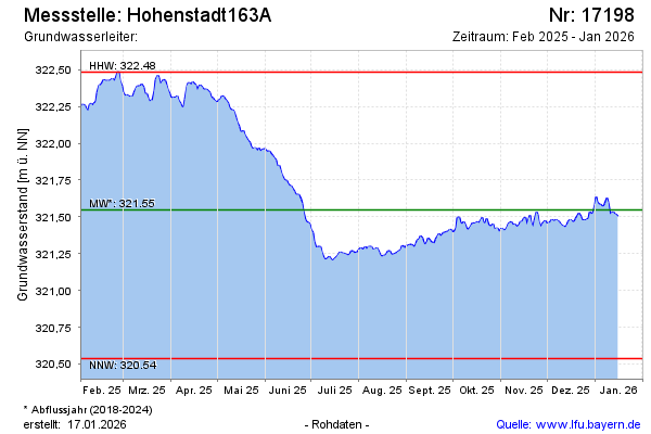
Groundwater level [m above sealevel]: 322.11
Distance to surface [m]:
Last value from 27.07.2024 06:00
Ground level [m above sealevel]: --
| Date | Groundwater level [m above sealevel] |
|---|---|
| 26.07.2024 | 322.15 |
| 25.07.2024 | 322.14 |
| 24.07.2024 | 322.13 |
| 23.07.2024 | 322.13 |
| 22.07.2024 | 322.15 |
| 21.07.2024 | 322.17 |
| 20.07.2024 | 322.18 |
| 19.07.2024 | 322.17 |
© Bayerisches Landesamt für Umwelt 2024