
- Start >
- Groundwater >
- Waterlevel of deep layer >
- Regnitz >
- Reichelsdorf B 5 >
- Chart of total period

Chart of total period Reichelsdorf B 5
Groundwater levels of the total period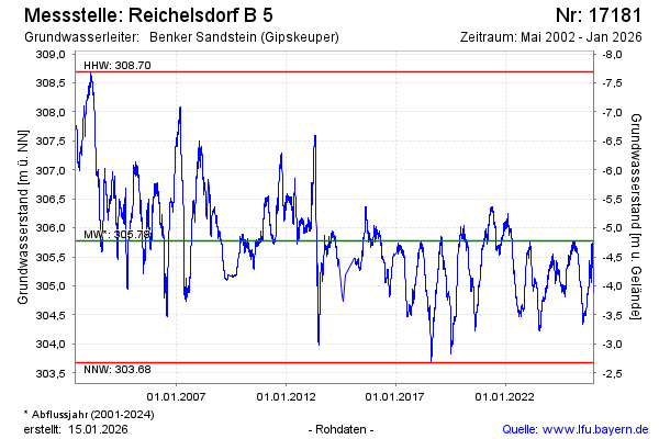
Groundwater level [m above sealevel]: 305.70
Distance to surface [m]: -4.70
Last value from 13.03.2025 09:00
Ground level [m above sealevel]: 301.00
| Date | Groundwater level [m above sealevel] |
|---|---|
| 13.03.2025 | 305.70 |
| 12.03.2025 | 305.69 |
| 11.03.2025 | 305.67 |
| 10.03.2025 | 305.68 |
| 09.03.2025 | 305.67 |
| 08.03.2025 | 305.64 |
| 07.03.2025 | 305.62 |
| 06.03.2025 | 305.62 |
© Bayerisches Landesamt für Umwelt 2025