
- Start >
- Groundwater >
- Waterlevel of deep layer >
- Regnitz >
- Tennenlohe B1 >
- Chart of total period

Chart of total period Tennenlohe B1
Groundwater levels of the total period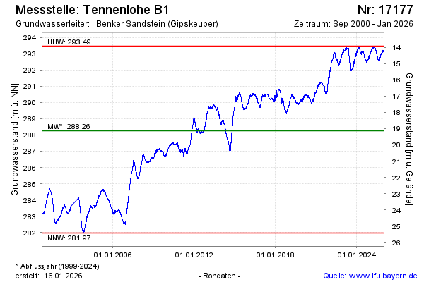
Groundwater level [m above sealevel]: 293.48
Distance to surface [m]: 13.91
Last value from 13.03.2025 09:00
Ground level [m above sealevel]: 307.39
| Date | Groundwater level [m above sealevel] |
|---|---|
| 13.03.2025 | 293.48 |
| 12.03.2025 | 293.47 |
| 11.03.2025 | 293.45 |
| 10.03.2025 | 293.45 |
| 09.03.2025 | 293.43 |
| 08.03.2025 | 293.39 |
| 07.03.2025 | 293.37 |
| 06.03.2025 | 293.35 |
© Bayerisches Landesamt für Umwelt 2025