
- Start >
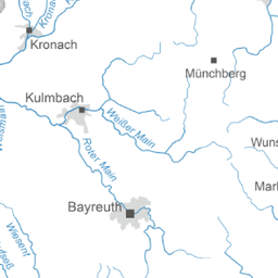
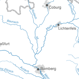
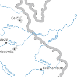
- Groundwater >
- Waterlevel of upper layer >
- Table: Oberer Main - Elbe

Upper groundwater layer Oberer Main - Elbe


Measurement site | County | Aquifer | Date | Groundwater level [m above sealevel] | Distance to surface [m] |
|---|---|---|---|---|---|
 EBERSDORF/COB. (KMS 3) EBERSDORF/COB. (KMS 3) | CO | Burg- und Blasensandstein (Sandsteinkeuper) | 27.04.2025 11:00 | 311.44 | 21.00 |
| MICHELAU 1 | LIF | Quartär | 27.04.2025 11:00 | 261.74 | 2.26 |
| MITWITZ(STEINACHTAL) A | KC | Mittlerer Buntsandstein | 28.04.2025 06:00 | 313.16 | 6.49 |
| Dietersdorf (KMS1) | CO | Burg- und Blasensandstein (Sandsteinkeuper) | 27.04.2025 11:00 | 271.06 | 2.73 |
| GÖSSERSDORF (S 2) | KC | Mittlerer Buntsandstein | 27.03.2025 10:55 | 364.49 | 11.53 |
| Hallstadt 16 | BA | Burg- und Blasensandstein (Sandsteinkeuper) | 27.04.2025 11:00 | 241.52 | 5.38 |
| Küps Q 1 | KC | Quartär | 27.04.2025 10:06 | 285.95 | 2.16 |
| RATTELSDORF 136 | BA | Quartär | 27.04.2025 09:00 | 241.64 | 3.83 |
| MELKENDORF 16B | KU | Quartär | 27.04.2025 10:00 | 295.20 | 1.51 |
| Klosterlangheim 19 | LIF | Burg- und Blasensandstein (Sandsteinkeuper) | 27.04.2025 11:00 | 285.81 | 19.79 |
| NEUENPLOS 119 | BT | Burg- und Blasensandstein (Sandsteinkeuper) | 27.04.2025 11:00 | 318.38 | 13.86 |
| LINDAU A | KU | Buntsandstein | 27.04.2025 10:00 | 330.56 | 13.35 |
| BUCHAU-BT-kms1 | KU | Burg- und Blasensandstein (Sandsteinkeuper) | 27.04.2025 11:00 | 328.80 | -8.95 |
| HOEFERAENGER BT-s1 | KU | Buntsandstein | 27.04.2025 11:00 | 330.78 | 3.28 |
| BUERGERWALD BT-kms4 | BT | Burg- und Blasensandstein (Sandsteinkeuper) | 27.04.2025 11:00 | 437.46 | 12.92 |
| LESSAU | BT | Benker Sandstein (Gipskeuper) | 27.04.2025 10:00 | 388.61 | -3.29 |
| LIMMERSDORFER FORST-kms2 | KU | Burg- und Blasensandstein (Sandsteinkeuper) | 27.04.2025 10:00 | 314.13 | 17.11 |
| THIERGARTEN-kms3 | BT | Burg- und Blasensandstein (Sandsteinkeuper) | 27.04.2025 10:00 | 375.40 | 7.82 |
| OTTMANNSREUTH - kbe1 | BT | Benker Sandstein (Gipskeuper) | 27.04.2025 10:00 | 389.98 | 27.03 |
| RAMSENTHAL GWM4 | BT | Buntsandstein | 27.04.2025 10:00 | 348.84 | 13.91 |
| Recheldorf KMS 1 | HAS | Burg- und Blasensandstein (Sandsteinkeuper) | 27.04.2025 11:00 | 256.92 | 21.80 |
| NEUSES | LIF | Quartär | 27.04.2025 09:00 | 272.44 | 0.78 |
| ROTHMANNSTHAL 11 | LIF | Weißer Jura / Malmkarst | 27.04.2025 10:00 | 447.31 | 23.62 |
| LEITENBACH (2) | BA | Quartär | 27.04.2025 11:00 | 235.44 | 5.10 |
| Baunach 18 | BA | Burg- und Blasensandstein (Sandsteinkeuper) | 27.04.2025 11:00 | 240.00 | 41.75 |
| Lohr KMS2 | HAS | Burg- und Blasensandstein (Sandsteinkeuper) | 27.04.2025 11:00 | 287.31 | 4.69 |
| Weichendorf 17 | BA | Burg- und Blasensandstein (Sandsteinkeuper) | 27.04.2025 10:00 | 241.39 | 24.81 |
| STAFFELSTEIN 33B | LIF | Quartär | 27.04.2025 10:01 | 257.65 | 2.50 |
| Heldritt | CO | Oberer Muschelkalk | 02.04.2025 14:10 | 346.08 | -24.01 |
| NENTSCHAU 29 | HO | Kristallines Grundgebirge | 27.04.2025 11:00 | 526.05 | 1.54 |
| OSCHWITZ-ZAUN 21A | Quartär | 27.04.2025 11:00 | 450.78 | 1.72 | |
| BIRK 131 | BT | Benker Sandstein (Gipskeuper) | 27.04.2025 11:00 | 406.24 | 7.78 |
| GOERINGSREUTH W 93/6 | 27.04.2025 11:00 | 589.99 | 12.87 | ||
| KULMBACH Blaich 1 | KU | 27.04.2025 10:45 | 302.48 | 2.86 | |
| KULMBACH Blaich 2 | KU | 27.04.2025 11:00 | 301.09 | 5.68 | |
| KULMBACH Blaich 3 | KU | 27.04.2025 10:45 | 300.87 | 4.20 | |
| KULMBACH Blaich 4 | KU | 27.04.2025 11:00 | 300.75 | 3.56 | |
| KULMBACH Blaich 5 | KU | 27.04.2025 11:00 | 299.80 | 4.39 | |
| STADTSTEINACH 9A | KU | Quartär | 27.04.2025 10:00 | 332.43 | 2.86 |
| Kulmbach Blaich 6 | KU | 27.04.2025 11:00 | 300.66 | 2.34 | |
| WEISSENSTADT 12A | Tertiär | 27.04.2025 10:00 | 605.09 | 1.99 | |
| SR/GW FICHTELGEB. 01 | HO | Kristallines Grundgebirge | 27.04.2025 10:00 | 761.46 | 6.89 |
| Kimmelsbach km S 1 | HAS | Schilfsandstein (Gipskeuper) | 27.04.2025 10:00 | 325.09 | 0.30 |
| Ibind km H2+3 | HAS | Burg- und Blasensandstein (Sandsteinkeuper) | 27.04.2025 10:00 | 317.93 | 32.43 |
| KALTENBRUNN 214 | CO | Quartär | 02.04.2025 12:50 | 253.83 | 1.76 |
| POELZ 19A | KU | Quartär | 27.04.2025 10:00 | 288.91 | 1.22 |
| BRUEDERES TR 130 | BT | Benker Sandstein (Gipskeuper) | 27.04.2025 10:00 | 409.26 | 4.81 |
| VB C Trebgasttal | KU | Buntsandstein | 27.04.2025 10:00 | 335.79 | 2.34 |
| TREBGAST B | KU | Buntsandstein | 27.04.2025 11:00 | 330.86 | 10.55 |
Explanations
Upper layer of groundwater
Depending of the thickness and porosity of the top coat measurement stations of the upper groundwater level show more or less fast reaction to rain. Groundwater measurement stations in the flood plain often shows a strong correlation to the waterlevels in the river.
 weiterführende Fachinformationen
© Bayerisches Landesamt für Umwelt 2025