
- Start >
- Groundwater >
- Waterlevel of upper layer >
- Bayern >
- ADELSRIED TA 1 F >
- Chart of total period

Chart of total period ADELSRIED TA 1 F
Groundwater levels of the total period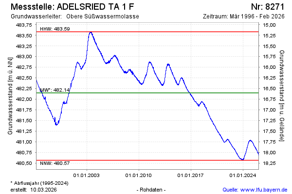
Groundwater level [m above sealevel]: 481.02
Distance to surface [m]: 17.73
Last value from 13.11.2024 14:46
Ground level [m above sealevel]: 498.75
| Date | Groundwater level [m above sealevel] |
|---|---|
| 13.11.2024 | 481.01 |
| 12.11.2024 | 481.01 |
| 11.11.2024 | 481.02 |
| 10.11.2024 | 481.01 |
| 09.11.2024 | 481.01 |
| 08.11.2024 | 481.01 |
| 07.11.2024 | 481.01 |
| 06.11.2024 | 481.01 |
© Bayerisches Landesamt für Umwelt 2024