
- Start >
- Groundwater >
- Waterlevel of upper layer >
- Bayern >
- AHOLMING_OP6 >
- Chart of total period

Chart of total period AHOLMING_OP6
Groundwater levels of the total period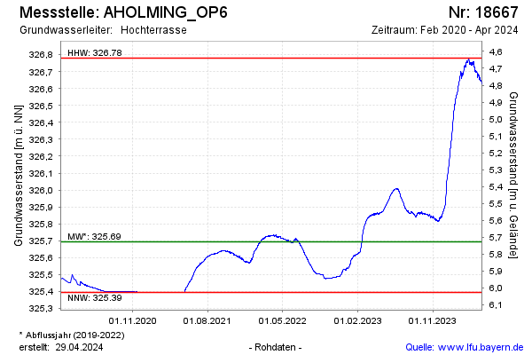
Groundwater level [m above sealevel]: 326.25
Distance to surface [m]: 5.17
Last value from 26.11.2024 08:00
Ground level [m above sealevel]: 331.42
| Date | Groundwater level [m above sealevel] |
|---|---|
| 27.11.2024 | 326.26 |
| 26.11.2024 | 326.26 |
| 25.11.2024 | 326.27 |
| 24.11.2024 | 326.26 |
| 23.11.2024 | 326.26 |
| 22.11.2024 | 326.27 |
| 21.11.2024 | 326.28 |
| 20.11.2024 | 326.28 |
© Bayerisches Landesamt für Umwelt 2024