
- Start >
- Groundwater >
- Waterlevel of upper layer >
- Bayern >
- AM WALDRAND 1 KO 46 >
- Year chart of precipitation

Year chart of precipitation AM WALDRAND 1 KO 46
Groundwater levels of the last 12 months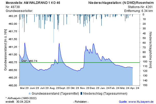
Groundwater level [m above sealevel]: 460,58
Distance to surface [m]: 2,66
Last value from 19.02.2025 11:35
Ground level [m above sealevel]: 463.24
© Bayerisches Landesamt für Umwelt 2025