
- Start >
- Groundwater >
- Waterlevel of upper layer >
- Bayern >
- AUF DER BURG 19 >
- Chart of total period

Chart of total period AUF DER BURG 19
Groundwater levels of the total period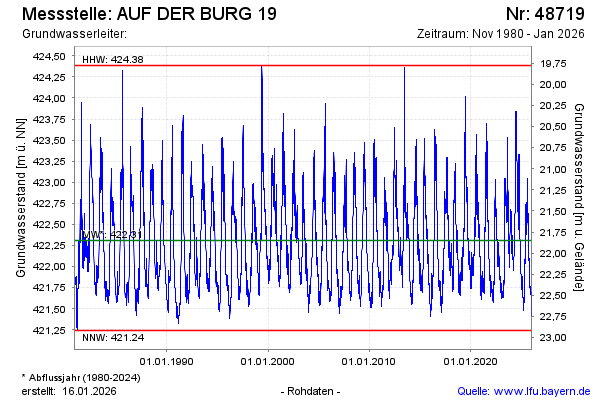
Groundwater level [m above sealevel]: 421.58
Distance to surface [m]: 22.58
Last value from 04.03.2025 11:53
Ground level [m above sealevel]: 444.16
| Date | Groundwater level [m above sealevel] |
|---|---|
| 04.03.2025 | 421.58 |
| 03.03.2025 | 421.59 |
| 02.03.2025 | 421.60 |
| 01.03.2025 | 421.61 |
| 28.02.2025 | 421.62 |
| 27.02.2025 | 421.64 |
| 26.02.2025 | 421.63 |
| 25.02.2025 | 421.63 |
© Bayerisches Landesamt für Umwelt 2025