
- Start >
- Groundwater >
- Waterlevel of upper layer >
- Bayern >
- AUF DER BURG 19 >
- Current data

Current data AUF DER BURG 19
Groundwater levels of the last 12 months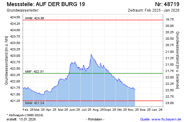
Groundwater level [m above sealevel]: 421.99
Distance to surface [m]: 22.17
Last value from 11.12.2024 14:51
Ground level [m above sealevel]: 444.16
| Date | Groundwater level [m above sealevel] |
|---|---|
| 11.12.2024 | 421.99 |
| 10.12.2024 | 421.95 |
| 09.12.2024 | 421.93 |
| 08.12.2024 | 421.95 |
| 07.12.2024 | 421.97 |
| 06.12.2024 | 421.97 |
| 05.12.2024 | 421.99 |
| 04.12.2024 | 421.97 |
© Bayerisches Landesamt für Umwelt 2025