
- Start >
- Groundwater >
- Waterlevel of upper layer >
- Bayern >
- Baiersdorf Q6 >
- Current data

Current data Baiersdorf Q6
Groundwater levels of the last 12 months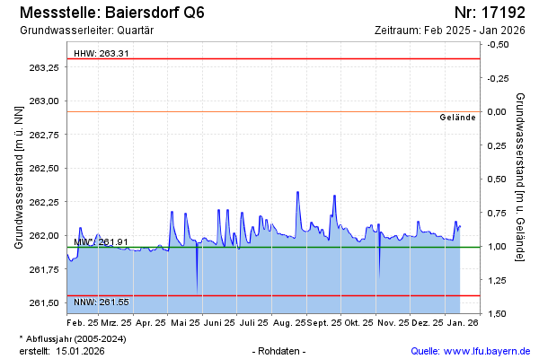
Groundwater level [m above sealevel]: 261.99
Distance to surface [m]: 0.93
Last value from 18.11.2024 17:00
Ground level [m above sealevel]: 262.92
| Date | Groundwater level [m above sealevel] |
|---|---|
| 18.11.2024 | 261.97 |
| 17.11.2024 | 261.93 |
| 16.11.2024 | 261.93 |
| 15.11.2024 | 261.93 |
| 14.11.2024 | 261.94 |
| 13.11.2024 | 261.97 |
| 12.11.2024 | 261.96 |
| 11.11.2024 | 261.93 |
© Bayerisches Landesamt für Umwelt 2024