
- Start >
- Groundwater >
- Waterlevel of upper layer >
- Bayern >
- BRUENNING 566 >
- Current data

Current data BRUENNING 566
Groundwater levels of the last 12 months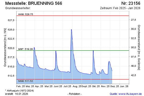
Groundwater level [m above sealevel]: 516.67
Distance to surface [m]: 38.03
Last value from 04.02.2025 08:00
Ground level [m above sealevel]: 554.70
| Date | Groundwater level [m above sealevel] |
|---|---|
| 04.02.2025 | 516.71 |
| 03.02.2025 | 516.86 |
| 02.02.2025 | 517.07 |
| 01.02.2025 | 517.24 |
| 31.01.2025 | 517.42 |
| 30.01.2025 | 517.51 |
| 29.01.2025 | 516.75 |
| 28.01.2025 | 516.36 |
© Bayerisches Landesamt für Umwelt 2025