
- Start >
- Groundwater >
- Waterlevel of upper layer >
- Bayern >
- BRUENNING 566 >
- Chart of total period

Chart of total period BRUENNING 566
Groundwater levels of the total period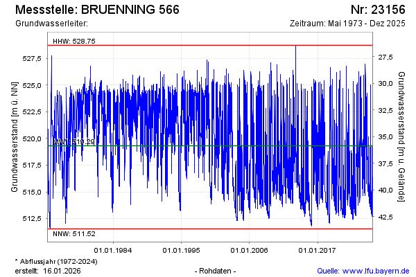
Groundwater level [m above sealevel]: 522.56
Distance to surface [m]: 32.14
Last value from 16.10.2024 12:00
Ground level [m above sealevel]: 554.70
| Date | Groundwater level [m above sealevel] |
|---|---|
| 16.10.2024 | 522.63 |
| 15.10.2024 | 522.24 |
| 14.10.2024 | 522.09 |
| 13.10.2024 | 523.03 |
| 12.10.2024 | 523.91 |
| 11.10.2024 | 524.23 |
| 10.10.2024 | 524.17 |
| 09.10.2024 | 523.15 |
© Bayerisches Landesamt für Umwelt 2024