
- Start >
- Groundwater >
- Waterlevel of upper layer >
- Bayern >
- Burgau HWS BGW 4 >
- Chart of total period

Chart of total period Burgau HWS BGW 4
Groundwater levels of the total period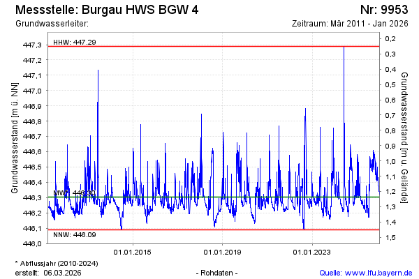
Groundwater level [m above sealevel]: 446.37
Distance to surface [m]: 1.17
Last value from 03.12.2024 10:36
Ground level [m above sealevel]: 447.54
| Date | Groundwater level [m above sealevel] |
|---|---|
| 03.12.2024 | 446.36 |
| 02.12.2024 | 446.33 |
| 01.12.2024 | 446.33 |
| 30.11.2024 | 446.34 |
| 29.11.2024 | 446.35 |
| 28.11.2024 | 446.33 |
| 27.11.2024 | 446.30 |
| 26.11.2024 | 446.29 |
© Bayerisches Landesamt für Umwelt 2025