
- Start >
- Groundwater >
- Waterlevel of upper layer >
- Bayern >
- Burgthann K 6 >
- Chart of total period

Chart of total period Burgthann K 6
Groundwater levels of the total period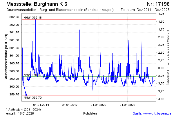
Groundwater level [m above sealevel]: 360.36
Distance to surface [m]: 3.24
Last value from 16.12.2024 10:30
Ground level [m above sealevel]: 363.60
| Date | Groundwater level [m above sealevel] |
|---|---|
| 16.12.2024 | 360.33 |
| 15.12.2024 | 360.30 |
| 14.12.2024 | 360.32 |
| 13.12.2024 | 360.32 |
| 12.12.2024 | 360.34 |
| 11.12.2024 | 360.37 |
| 10.12.2024 | 360.41 |
| 09.12.2024 | 360.48 |
© Bayerisches Landesamt für Umwelt 2025