
- Start >
- Groundwater >
- Waterlevel of upper layer >
- Bayern >
- DB-FAHRLEITUNGSBAU 36 >
- Chart of total period

Chart of total period DB-FAHRLEITUNGSBAU 36
Groundwater levels of the total period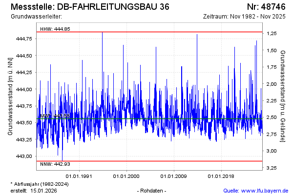
Groundwater level [m above sealevel]: 443.57
Distance to surface [m]: 2.51
Last value from 07.01.2025 15:43
Ground level [m above sealevel]: 446.08
| Date | Groundwater level [m above sealevel] |
|---|---|
| 07.01.2025 | 443.57 |
| 06.01.2025 | 443.54 |
| 05.01.2025 | 443.50 |
| 04.01.2025 | 443.50 |
| 03.01.2025 | 443.50 |
| 02.01.2025 | 443.50 |
| 01.01.2025 | 443.51 |
| 31.12.2024 | 443.52 |
© Bayerisches Landesamt für Umwelt 2025