
- Start >
- Groundwater >
- Waterlevel of upper layer >
- Bayern >
- Dietersdorf (KMS1) >
- Current data

Current data Dietersdorf (KMS1)
Groundwater levels of the last 12 months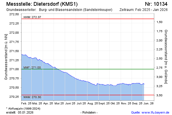
Groundwater level [m above sealevel]: 270.93
Distance to surface [m]: 2.86
Last value from 24.11.2024 10:00
Ground level [m above sealevel]: 273.79
| Date | Groundwater level [m above sealevel] |
|---|---|
| 24.11.2024 | 270.93 |
| 23.11.2024 | 270.93 |
| 22.11.2024 | 270.95 |
| 21.11.2024 | 270.95 |
| 20.11.2024 | 270.95 |
| 19.11.2024 | 270.93 |
| 18.11.2024 | 270.91 |
| 17.11.2024 | 270.91 |
© Bayerisches Landesamt für Umwelt 2024