
- Start >
- Groundwater >
- Waterlevel of upper layer >
- Bayern >
- DORNACH 553 >
- Chart of total period

Chart of total period DORNACH 553
Groundwater levels of the total period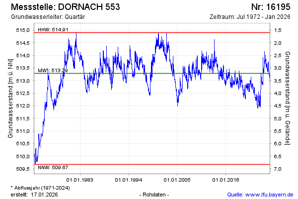
Groundwater level [m above sealevel]: 513.69
Distance to surface [m]: 2.81
Last value from 23.11.2024 09:00
Ground level [m above sealevel]: 516.50
| Date | Groundwater level [m above sealevel] |
|---|---|
| 23.11.2024 | 513.69 |
| 22.11.2024 | 513.70 |
| 21.11.2024 | 513.71 |
| 20.11.2024 | 513.71 |
| 19.11.2024 | 513.69 |
| 18.11.2024 | 513.70 |
| 17.11.2024 | 513.70 |
| 16.11.2024 | 513.70 |
© Bayerisches Landesamt für Umwelt 2024