
- Start >
- Groundwater >
- Waterlevel of upper layer >
- Bayern >
- EHAM WESTLICH >
- Chart of total period

Chart of total period EHAM WESTLICH
Groundwater levels of the total period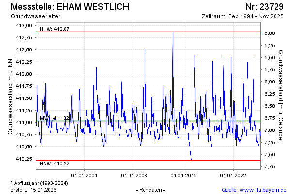
Groundwater level [m above sealevel]: 411.44
Distance to surface [m]: 6.40
Last value from 01.07.2024 19:08
Ground level [m above sealevel]: 417.84
| Date | Groundwater level [m above sealevel] |
|---|---|
| 01.07.2024 | 411.44 |
| 30.06.2024 | 411.46 |
| 29.06.2024 | 411.48 |
| 28.06.2024 | 411.49 |
| 27.06.2024 | 411.51 |
| 26.06.2024 | 411.52 |
| 25.06.2024 | 411.53 |
| 24.06.2024 | 411.54 |
© Bayerisches Landesamt für Umwelt 2025