
- Start >
- Groundwater >
- Waterlevel of upper layer >
- Bayern >
- Emmerting - A3 >
- Chart of total period

Chart of total period Emmerting - A3
Groundwater levels of the total period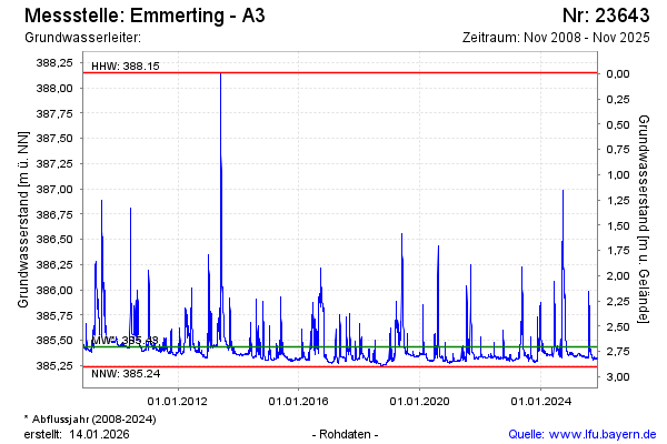
Groundwater level [m above sealevel]: 385.36
Distance to surface [m]: 2.78
Last value from 04.12.2024 09:00
Ground level [m above sealevel]: 388.14
| Date | Groundwater level [m above sealevel] |
|---|---|
| 04.12.2024 | 385.36 |
| 03.12.2024 | 385.36 |
| 02.12.2024 | 385.36 |
| 01.12.2024 | 385.36 |
| 30.11.2024 | 385.36 |
| 29.11.2024 | 385.36 |
| 28.11.2024 | 385.36 |
| 27.11.2024 | 385.35 |
© Bayerisches Landesamt für Umwelt 2024