
- Start >
- Groundwater >
- Waterlevel of upper layer >
- Bayern >
- ENGELSBERG D 7A >
- Chart of total period

Chart of total period ENGELSBERG D 7A
Groundwater levels of the total period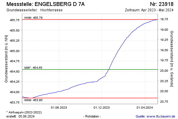
Groundwater level [m above sealevel]: 456.86
Distance to surface [m]: 17.66
Last value from 08.10.2024 10:00
Ground level [m above sealevel]: 474.52
| Date | Groundwater level [m above sealevel] |
|---|---|
| 08.10.2024 | 456.86 |
| 07.10.2024 | 456.85 |
| 06.10.2024 | 456.84 |
| 05.10.2024 | 456.83 |
| 04.10.2024 | 456.82 |
| 03.10.2024 | 456.81 |
| 02.10.2024 | 456.80 |
| 01.10.2024 | 456.79 |
© Bayerisches Landesamt für Umwelt 2024