
- Start >
- Groundwater >
- Waterlevel of upper layer >
- Bayern >
- Erding-Siglfing >
- Current data

Current data Erding-Siglfing
Groundwater levels of the last 12 months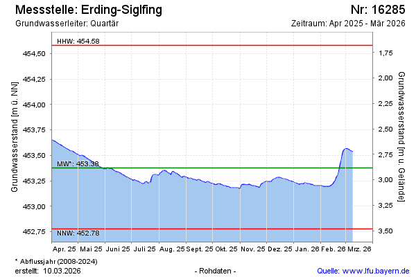
Groundwater level [m above sealevel]: 453.83
Distance to surface [m]: 2.43
Last value from 16.02.2025 09:00
Ground level [m above sealevel]: 456.26
| Date | Groundwater level [m above sealevel] |
|---|---|
| 16.02.2025 | 453.84 |
| 15.02.2025 | 453.84 |
| 14.02.2025 | 453.84 |
| 13.02.2025 | 453.85 |
| 12.02.2025 | 453.85 |
| 11.02.2025 | 453.85 |
| 10.02.2025 | 453.85 |
| 09.02.2025 | 453.86 |
© Bayerisches Landesamt für Umwelt 2025