
- Start >
- Groundwater >
- Waterlevel of upper layer >
- Bayern >
- Erlau Q 4 >
- Chart of total period

Chart of total period Erlau Q 4
Groundwater levels of the total period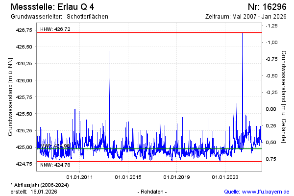
Groundwater level [m above sealevel]: 424.97
Distance to surface [m]: 0.60
Last value from 12.03.2025 10:00
Ground level [m above sealevel]: 425.57
| Date | Groundwater level [m above sealevel] |
|---|---|
| 12.03.2025 | 424.97 |
| 11.03.2025 | 424.96 |
| 10.03.2025 | 424.95 |
| 09.03.2025 | 424.94 |
| 08.03.2025 | 424.92 |
| 07.03.2025 | 424.91 |
| 06.03.2025 | 424.91 |
| 05.03.2025 | 424.92 |
© Bayerisches Landesamt für Umwelt 2025