
- Start >
- Groundwater >
- Waterlevel of upper layer >
- Bayern >
- ERLSTAETT D 20 >
- Chart of total period

Chart of total period ERLSTAETT D 20
Groundwater levels of the total period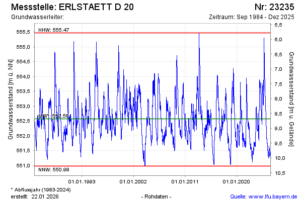
Groundwater level [m above sealevel]: 553.44
Distance to surface [m]: 7.81
Last value from 04.12.2024 07:22
Ground level [m above sealevel]: 561.25
| Date | Groundwater level [m above sealevel] |
|---|---|
| 04.12.2024 | 553.44 |
| 03.12.2024 | 553.46 |
| 02.12.2024 | 553.48 |
| 01.12.2024 | 553.50 |
| 30.11.2024 | 553.52 |
| 29.11.2024 | 553.54 |
| 28.11.2024 | 553.55 |
| 27.11.2024 | 553.57 |
© Bayerisches Landesamt für Umwelt 2025