
- Start >
- Groundwater >
- Waterlevel of upper layer >
- Bayern >
- Ernstfeld >
- Chart of total period

Chart of total period Ernstfeld
Groundwater levels of the total period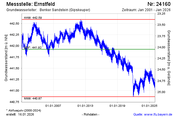
Groundwater level [m above sealevel]: 441.30
Distance to surface [m]: 24.67
Last value from 26.08.2024 09:54
Ground level [m above sealevel]: 465.97
| Date | Groundwater level [m above sealevel] |
|---|---|
| 26.08.2024 | 441.30 |
| 25.08.2024 | 441.31 |
| 24.08.2024 | 441.36 |
| 23.08.2024 | 441.36 |
| 22.08.2024 | 441.35 |
| 21.08.2024 | 441.35 |
| 20.08.2024 | 441.36 |
| 19.08.2024 | 441.34 |
© Bayerisches Landesamt für Umwelt 2024